He possesses strong expertise in MySQL, PHP, and web-based technologies, with proven proficiency in database management, system automation, and troubleshooting. Holding a Bachelor’s degree in Computer Science & Engineering from KIIT University and a Diploma in Computer Science from KIIT Polytechnic, he has also earned certifications in Big Data Hadoop and Java from Microsoft Tech Associate, Kolkata. Recognized for his problem-solving approach, adaptability, and collaborative mindset, he consistently drives improvements in system reliability, IT efficiency, and overall organizational performance.
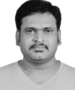
SATYAJEET MISHRA
Exploration Manager
Satyajeit Mishra is an experienced geologist with over 12 years of expertise in mineral exploration, open-cast mining operations, and resource evaluation across India and Central Africa. A postgraduate in Applied Geology from the National Institute of Technology (NIT) Raipur, he has worked across a diverse range of commodities including chromite, copper-cobalt, gold, 3T minerals, iron ore, limestone, manganese, coal, and minor minerals. His professional highlights include leading exploration and drilling operations across a 202 sq.km lease in the Democratic Republic of Congo with Golden African Resources Plc, where he successfully discovered multiple copper mineralization zones. In India, his work with Balasore Alloys Ltd. contributed to record-high chrome ore extraction and dispatch, driven by strategic production planning and regulatory compliance.
In addition to his core mining and exploration roles, Satyajeit has worked as a consultant with Geogenesis Pvt. Ltd., collaborating with district administrations on minor mineral block development and infrastructure material projects in Odisha and Jharkhand. His skillset spans QA/QC design, geochemical sampling, 3D orebody modeling, and database management, enabling him to bridge field-based geological work with technical reporting and resource evaluation. Technically adept and field-focused, Satyajeit is committed to sustainable mineral development and continues to deliver scalable geological solutions aligned with global best practices.
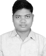
SOUMYA RANJAN JENA
Manager IT
Soumya Ranjan Jena is a dedicated and results-driven System Administrator with over two years of experience in managing, maintaining, and optimizing IT infrastructure across Windows and Linux environments. He specializes in server administration, network maintenance, virtualization, and data backup operations, ensuring smooth and reliable business continuity. His technical expertise includes MySQL, PHP, and web-based technologies, along with strong skills in database management, system automation, and troubleshooting.
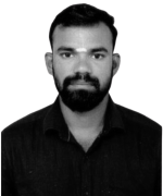
GOPINATH CHANDRASEKARAN
Geophysicist
C. Gopinath is a dedicated and results-driven Field Geologist with over 5 years of professional experience in mineral exploration and hydrogeological assessments across diverse geological settings. His expertise spans a wide range of commodities including copper, manganese, graphite, limestone, granite, and groundwater resources. Having contributed to over 30 successful projects in both domestic and international contexts—including assignments in India and Zambia—he brings a strong track record in geological mapping, core logging, reserve estimation, and technical report preparation.
Holding an Integrated M.Sc. in Geology and a Postgraduate Diploma in Petroleum Exploration from Annamalai University, Mr. Gopinath blends academic depth with hands-on field expertise. He is a Resource Qualified Person and has undertaken notable work in water chemistry, demonstrating interdisciplinary competency in both solid earth and environmental geology. Known for his practical approach, attention to detail, and commitment to quality, he consistently delivers data-driven insights to support efficient and sustainable resource development.

ABHISIKTA ROUT
GIS Analyst
Abhisikta Rout is a highly driven and detail-oriented Geologist and GIS Analyst with hands-on experience in geological mapping, mineral exploration, and spatial data analysis. Currently engaged with Shanvi Resources Pvt. Ltd., she specializes in processing satellite imagery (Landsat 8, SRTM DEM), terrain modeling, and CPR report preparation aligned with JORC standards. Her expertise is underpinned by strong technical proficiency in ArcGIS, QGIS, and analytical tools including CHNS and GC.
With a strong academic foundation—holding a Master’s in Geology from the Central University of Kerala—Abhisikta has contributed to diverse projects ranging from methane emission analysis to landslide susceptibility assessment using geospatial and multi-criteria decision-making (AHP-MCDM) techniques. Her fieldwork spans across major geological basins in India, including chromite mining in Odisha, basin mapping in Chhattisgarh, and sedimentary studies in Rajasthan.Known for her adaptability, problem-solving skills, and commitment to excellence, she brings a multidisciplinary approach to geological research and data-driven resource evaluation, making her a valuable asset in both field and analytical environments.

SEJUTI MONDAL
Geologist
Sejuti Mondal is a motivated and detail-oriented Geologist with a Master’s degree in Applied Geology from the University of Calcutta. She possesses a strong foundation in geological mapping, environmental impact assessments, hydrogeology, and remote sensing. With practical experience gained through fieldwork across India and an industry role at Ultra-Tech Environmental Consultancy, she has developed expertise in EIA reporting, baseline data analysis, and mine site evaluations involving dolomite, limestone, and sandstone.
Sejuti is proficient in geospatial technologies including ArcGIS, QGIS, AutoCAD, and ENVI, with a demonstrated ability to integrate geodata for environmental and mineral resource assessments. Her academic research on foraminiferal biostratigraphy and hands-on training at Singareni Collieries have enhanced her analytical and subsurface explorationskills. Recognized for her adaptability, scientific curiosity, and commitment to sustainable development, she brings both academic depth and field-ready competence to any geoscience-focused organization.

BIBHUTY BHUSAN CHHATRIA
Geologist
Bibhuty Bhusan Chhatria is a dedicated and emerging geoscience professional with practical experience in mineral exploration, geological mapping, and hydrogeological research. Holding a Master’s degree in Applied Geology from the National Institute of Technology (NIT) Raipur, he has actively contributed to industry and academic projects across India. His professional engagements include chromite quality control with Odisha Mining Corporation, hydrological analysis of the Doon Valley during his internship at the Wadia Institute of Himalayan Geology, and graphite exploration as a Trainee Geologist at Maa Kudargarhi Steels Pvt. Ltd. Bibhuty’s diverse field exposure includes key geological sites such as the Sonakhan Greenstone Belt, Malanjkhand Copper Mines, and the limestone and manganese deposits of Chhattisgarh and Madhya Pradesh.
Technically proficient in ArcGIS, AutoCAD, and thin section analysis, Bibhuty combines analytical skills with hands-on fieldwork to address real-world challenges in the geosciences. He is passionate about integrating scientific understanding with sustainable resource development and is committed to contributing to India’s mineral and environmental sectors through innovative, data-driven geological solutions.
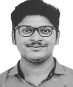
THULASIMANI ARUMUGAM
Exploration Geologist
Thulasimani Arumugam is a passionate geoscience professional with expertise in geological exploration, hydrogeological studies, and spatial data analysis. She holds a Master’s degree in Geology from Annamalai University and currently works as an Assistant Geologist at Geological Exploration and Mining Solutions Pvt. Ltd., Salem. Her experience spans mineral assessment, geological mapping, and environmental data interpretation across diverse terrains.
Trained by the Geological Survey of India and skilled in tools like ArcGIS, QGIS, AutoCAD, and LiDAR, Thulasimani blends fieldwork with analytical precision. Her research on groundwater quality in ultramafic regions highlights her environmental focus. Committed to sustainable resource development, she brings adaptability, teamwork, and a data-driven approach to India’s geoscience and mining sectors.

Nishanth L
Exploration Geologist
Nishanth L is a passionate and detail-oriented Geologist with practical experience in mineral exploration, geochemical analysis, and GIS-based geological interpretation. With a solid academic background and extensive field exposure, he has worked on mapping, sampling, and quality control operations across various mineral deposits, including mica, limestone, magnesite, uranium, and baryte. Currently pursuing his Master’s in Applied Geology from the College of Engineering, Guindy (Anna University), Nishanth has gained hands-on experience through internships at the National Institute of Oceanography (NIO), Goa, and IREL (India) Limited, Manavalakurichi, where he developed expertise in geochemical instrumentation, laboratory techniques, and mineral processing.
Proficient in ArcGIS, QGIS, Google Earth Pro, and analytical tools such as AAS and UV-Vis spectrophotometry, Nishanth integrates scientific knowledge with advanced spatial analysis to interpret geological and environmental data. His project on “Groundwater Vulnerability to Seawater Intrusion Using the GALDIT Model” highlights his strength in spatial modeling and hydrochemical analysis. Recognized with the Kattabomman Merit Endowment Scholarship (2022–2023), he continues to expand his expertise in applied geology, geospatial analytics, and resource evaluation, aiming to contribute to sustainable mining and environmental studies.
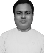
SUKANTA KUMAR MANDALA
Chemist
Sukanta Kumar Mandala is a highly experienced analytical chemist and mining-metals professional with over two decades of demonstrated expertise in laboratory management, quality-control processes and analytical instrumentation within India and the Democratic Republic of Congo. He has built his career on rigorous sample analysis, method development, and oversight of laboratory workflows in demanding metallurgical and mining-based environments.
Holding a Bachelor’s Honours in Chemistry, he has progressed from chemist roles in India to supervisory positions overseas. His expertise encompasses the analysis of raw materials, salts, solvent systems, and ore-based products such as cobalt, copper, gold, and graphite. He is proficient in operating advanced instrumentation, including atomic absorption spectrophotometers, UV/Vis spectrometers, ICP, XRF, OES, and ion-specific meters, enabling teams to meet high standards of regulatory compliance and production accuracy. His leadership demonstrates strong capabilities in research & development, decision-making, time management, and resource optimization. Fluent in English, Hindi, and Swahili, and highly proficient with Microsoft Office and Google Drive tools, he is well-positioned to support organizations aiming to elevate their analytical workflows, strengthen quality control systems, and integrate laboratory outputs with mining operations.
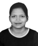
Sampujini Patra
Associate- Finance and Accounts
Sampujini Patra is a motivated accounting professional with over 1.5 years of experience in financial accounting, reporting, and compliance. She has demonstrated expertise in day-to-day accounting operations, bank and ledger reconciliations, tax calculations, and preparation of statutory returns including sales tax, entry tax, and professional tax. Sampujini is proficient in accounting software such as Tally ERP and Zoho Books, ensuring accurate bookkeeping and efficient financial management.
Her experience also includes roles in invoice processing, vendor reconciliations, salary processing, and compliance calendar management. Currently pursuing a Master of Commerce degree from Indira Gandhi National Open University, Sampujini combines strong analytical skills with effective communication to support smooth financial operations and organizational decision-making. Fluent in English, Hindi, and Odia, she is committed to continuous learning and delivering precise, reliable accounting solutions
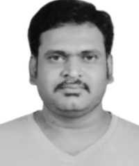
SATYAJEIT MISHRA
Exploration Manager
Satyajeit is a seasoned Geologist with over 12 years of experience in mineral exploration, open-cast mining, and resource evaluation across India and Central Africa. He’s passionate about driving sustainable mineral development, bringing deep technical expertise in exploration management, resource modeling, and project leadership to deliver impactful and responsible mining solutions.
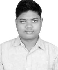
SOUMYA RANJENA JENA
Manager IT
Soumya is a dedicated System Administrator with extensive hands-on experience in managing and optimizing IT infrastructure across Windows and Linux environments. He’s passionate about server management, virtualization, and network security, bringing deep technical expertise in system administration, infrastructure optimization, and operational efficiency.
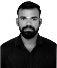
C. GOPINATH
Geophysicist
C. Gopinath is a dedicated Field Geologist with over 5 years of experience in mineral exploration and hydrogeological studies across India and Zambia. Holding an Integrated M.Sc. in Geology .He has worked on a wide range of commodities including copper, manganese, graphite, and limestone, combining strong field expertise with data-driven geological insights for sustainable resource development.
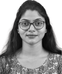
ABHISIKTA ROUT
GIS Analyst
Abhisikta is a driven Geologist and GIS Analyst with expertise in geological mapping, mineral exploration, and spatial data analysis. She’s passionate about applying remote sensing and terrain modeling to support sustainable resource development, bringing deep technical expertise in GIS interpretation, CPR report preparation aligned with JORC standards, and project execution with analytical precision.
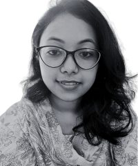
SEJUTI MONDAL
Geologist
Sejuti is a motivated and detail-oriented Geologist with expertise in geological mapping, environmental impact assessments, hydrogeology, and remote sensing. She’s passionate about sustainable mineral and environmental development, bringing deep technical expertise in EIA reporting, baseline data analysis, mine site evaluations, and geospatial analysis using ArcGIS, QGIS, AutoCAD, and Global mapper to every project.

BIBHUTY BHUSAN CHHATRIA
Geologist
Bibhuty is a geoscience professional with expertise in mineral exploration and hydrogeology. He’s passionate about sustainable resource development and brings experience in field mapping and chromite and graphite projects. His work spans key sites across India, including Sonakhan Greenstone Belt and Malanjkhand Copper Mines. Proficient in ArcGIS and AutoCAD, he applies geospatial and analytical skills to deliver solutions.
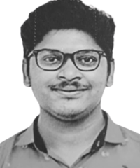
THULASIMANI ARUMUGAM
Exploration Geologist
Thulasimani Arumugam is a geoscience professional with expertise in geological exploration, hydrogeology, and spatial data analysis. She’s passionate about sustainable resource development and brings experience in mineral assessment, geological mapping, and environmental interpretation. Proficient in ArcGIS, QGIS, AutoCAD, and LiDAR, she integrates fieldwork with analytical skills to deliver data-driven solutions.

Nishanth L
Exploration Geologist
Nishanth is a geoscience professional with expertise in mineral exploration, geochemical analysis, and GIS-based geological interpretation. He’s passionate about sustainable resource development and brings experience in mapping, sampling, and quality control across various mineral deposits. Proficient in ArcGIS, QGIS, Google Earth Pro, and analytical tools, he integrates fieldwork with spatial and laboratory analysis to deliver data-driven geological solutions.
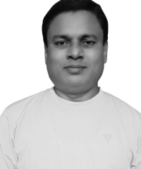
SUKANTA KUMAR MANDALA
Chemist
Sukanta Kumar Mandala is an analytical chemist and mining-metals professional with expertise in laboratory management and quality control. He’s passionate about accurate and efficient resource evaluation, bringing experience in sample analysis, method development, and oversight of metallurgical workflows.Proficient in AAS, UV/Vis, ICP, and XRF, other analytical tools. he delivers accurate, data-driven solutions for mining operations.
All Members
HR & Accounts
Sales & Marketing
IT Support
